Project Detail Pages: 1. 2. 3. 4. 5. 6. 7.
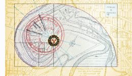
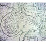
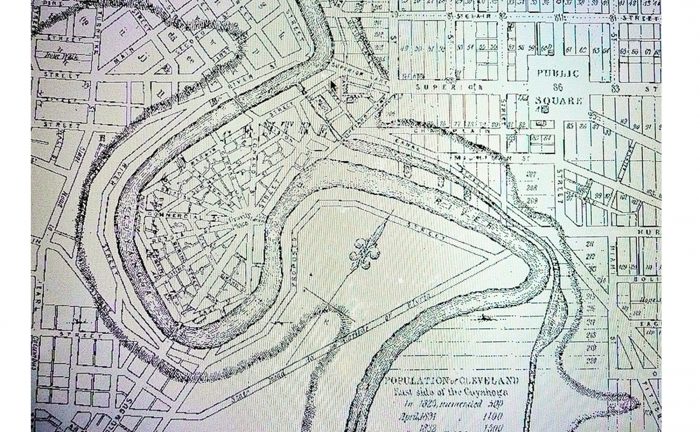
The 1833 Archive Map
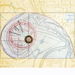
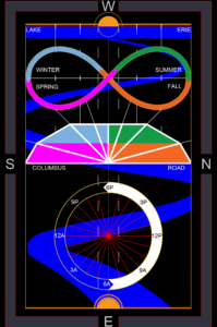
Looking at the Archive Map by Chief City Engineer, Ahaz Merchant, shows a street grid encompassing Columbus Peninsula and within this river edge, the Cleveland Centre blueprint emanates. Originating dynamically from its midsection, the center-point location named, ‘Gravity Place’ fixed its hub on the rising sun, establishing a still point in the movement of time. From this central relationship a sunburst of streets fan west toward the sunset on the horizon of Lake Erie. The City Centre emanates the enclosure of an observatory tracking the movement of daylight and the sequence of seasonal change.

Current Map of Cuyahoga National Park
In 1796 Moses Cleveland surveyed a Euclidian Grid imposing a New England town square in the Western Reserve frontier for real estate speculation. By 1833 the Cleveland village had 5,000 residents. As population spread out between East and West side settlements at the mouth of the Cuyahoga River, “Public Square” was not adequate to provide unity for the city, divided by growth and demanding a greater order.
 Dedicated with the Ohio Erie Canal, the Centre established Columbus Road as the N/S axis in the environment. Originating dynamically from its midsection, the centerpiece division named “Gravity Place” astronomically fixed its hub on the rising and setting sun. At this midpoint a sunburst pattern of streets fanned westward across the peninsula creating interior allotments intended for residential and commercial growth. Streets named for various migrating nationalities ~Russia, China, German, British, French~ bisected roads named for the seasons. A Symbol of unity, penetrating barriers of language, as kinship with nature and the man were linked.

Ten years after Cleveland Centre and the Canal were established, Cleveland population zoomed to 20 thousand. Railroads, a cheaper source of transport moved in. Taking the path of least resistance, tracks followed the low-lying lakeshore and rivers edge routes. Cleveland Centre streets became active rail yards, erasing the west end of the peninsula, altering the road radius circulation. All land uses remained except for residential, driven away by industrial growth. For the next 180 years, without the critical circulation function the organizing principle of Cleveland Centre was forgotten.
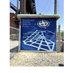
Sine and Cosine Visualized:
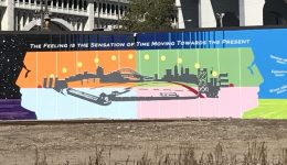
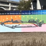
In following life-cycles that coincide with human order, we discover global rotation is in relation to our greater reality. Situating everything, the boundary of self disappears, united to the harmonic forces of the earth. Here the face of the Cleveland Centre becomes an historic attraction connecting Cleveland and the Canalway Towpath Trail to the Cuyahoga Valley National Park – where outdoor exposure is a basic nutrient of life.
 “For nature near home will create more respect, care, and political support for National Parks developing the conservation constituency in a newer generation that will need to protect their country’s historic sites, scenic wonders and sacred places…protecting their country’s historic sites…The National Parks are our holy places.”
Johnathan Jarvis visiting the Cuyahoga River in Cleveland, Ohio
Project Detail Pages: 1. 2. 3. 4. 5. 6.7.
Related posts